Interactive imagery powered by
GIBS,
catalog search powered by CMR —
the friendly door to two services normally only used by NASA researchers.
1. Today's view of Earth
Pick a layer below and a date — this is a live tile feed from NASA's GIBS service. Pan, zoom, and the imagery streams in. Same data, same satellites, that NASA Worldview shows — just simpler.
Layer name + date controls the URL pattern: https://gibs.earthdata.nasa.gov/wmts/{epsg}/best/{layer}/default/{date}/{tile-matrix}/{z}/{y}/{x}.{format}. GIBS supports 1000+ layers — these 11 are the most commonly explored.
Not a daily basemap layer? Explore it in the cloud
Some key datasets aren't part of the GIBS daily feed above — Landsat's full archive is cloud-hosted, and NAIP is airborne US imagery. Open them directly with no login via AWS Earth Search, or read the plain-English page:
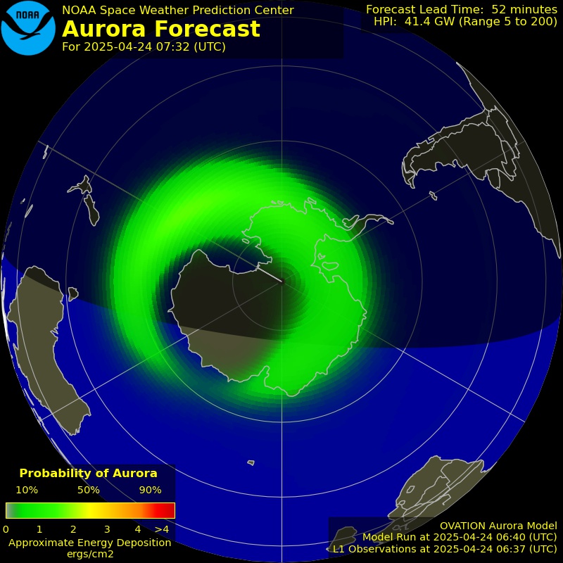
Genuinely live feeds you can just watch: the Sun refreshed every ~15 minutes by NASA's Solar Dynamics Observatory, and NOAA's aurora forecast. Refresh the page for the latest frames.
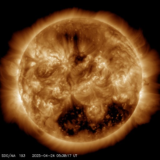
AIA 193 Å
1.2M K corona
Hot corona and coronal holes — the source of fast solar wind.
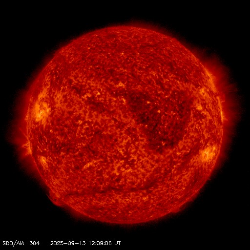
AIA 304 Å
50K K chromosphere
Cooler chromosphere — prominences and filaments along the limb.
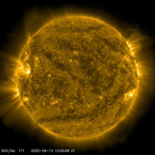
AIA 171 Å
600K K quiet corona
Magnetic loops arching over active regions.
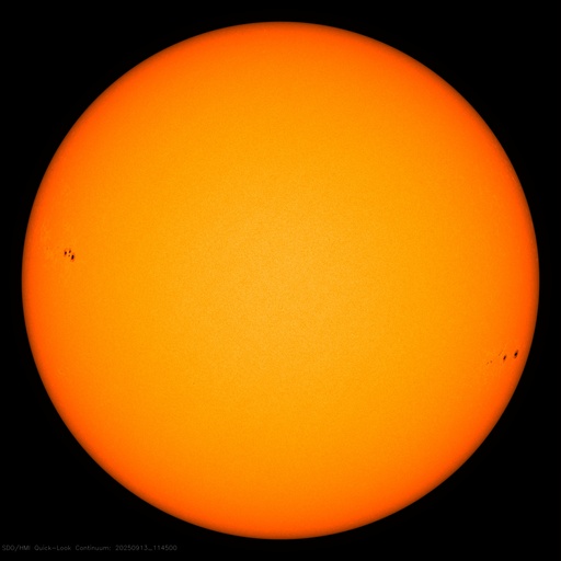
HMI Continuum
visible surface
The photosphere — sunspots mark intense magnetic fields.
Northern hemisphere · auroral oval probability · NOAA SWPC OVATION
Southern hemisphere · auroral oval probability · NOAA SWPC OVATION
3. Search NASA's catalog
Search the 3000 most-used NASA collections in plain English — instant, offline, no API call. Need the long tail? One click searches all 54,000 collections live. Or browse the full thing on the Catalog page.
Local results come from a cached, plain-English index of the top 3000 collections by usage. The live fallback hits cmr.earthdata.nasa.gov directly.
4. Pre-built stories
Worldview has its own "stories" feature — pre-built scenes for specific events. Here are 6 of the most-cited NASA EO moments, jump-linked to the corresponding map view above.
NASA's catalog system. Every dataset, every granule, every collection — indexed and searchable via REST API. The map and search above both ride on top of CMR. Without CMR, no NASA Earth data tool works.
The tile server behind Worldview + Earthdata Search + 100s of third-party apps. 1000+ pre-rendered visualizations across 35 years of data. The map above is GIBS tiles — same source NASA's own apps use.
The official UI for browsing GIBS. Has stories, layer comparison, animation, swipe. Powerful but dense. This Atlas surfaces the same data with friendlier navigation.
The official tool for finding + downloading data (sits on top of CMR). Use when you want to actually fetch granules. The CMR search above is read-only browse; Earthdata Search lets you select + download.